All Good Things Must Come to An End

Recently, my job has been changed. Since I've now toured all four different plate boundaries, my recent project has been completed as I turned in all of my entries to Environment Magazine.

Now, since many are interested at the status of the areas hit by the recent earthquake/tsunami, I will be staying in Japan. I'm now reporting about my experiences in these cities and the people who survived the horrible incident, but I'm so busy between writing magazine articles and volunteering under the Red Cross foundation, that I no longer have time to update this blog!

So, as always, another good thing comes to an end.
But, helping in the wake of destruction, I have to to realize the positive impact that my help has given other people.

So help. Donate. Learn more science. Become a plates expert.

Because, in the end, it will domino into something great. Involvement in the earth is involvement in the greater good of the human race.

Signing off,
Carly

Google Earth Tour

My Google Earth tour, from start to finish. All the locations I visited on there, and now you can follow in my footsteps!

Click

Japan Earthquake + Tsunami


Above is a picture of the tsunami that struck the northeastern coast of Japan, before the waters receded. It was caused by the earthquake that hit minutes before.

The earthquake happened where the Pacific plate is subducting underneath the plate beneath Honshu (scientist aren’t sure which plate exactly). There’s been tension building up for years and years as edge of the Pacific plate is being dragged down. The earthquake happened when the tension was suddenly released, and the edge of the plate snapped up. This caused the tension/pressure to move out across Japan, and shake the earth as the pressure was transferred to other plates. As this pressure built up again, aftershocks occurred.


The tsunami happens when the plate snaps up, and, since the plate boundary is under the ocean, the shock pushes the water up. The water forms a dome, and spreads out across the ocean as a large wave. The deeper the water is when the tsunami forms, the faster it travels. Unfortunately, the plate snapped at a location near the Japan Trench (my previous location), where the ocean depth is quite great.

This created a very fast moving wave, that struck quickly after the earthquake struck. It was very destructive along the northeast coast of Japan. Even towns that had tsunami walls were not safe, for the earthquake dropped the coast two feet.


In the wake of the destruction, there is only the remains of houses, and bodies of those who lost their lives in the disaster. It was a bleak sight as I trudged through the debris, clearing it away as I helped prepare to rebuild the houses that stood there only a month ago.

It’s not easy, but it’s the least I can do to help some of the thousands of people retaliate from this disaster. I only hope my work positively impacted their lives.

Here’s to looking hopeful,
Carly

Japan Trench

This time, I got to go back underwater, to visit the Japan Trench.  A submarine took me down into this oceanic trench, in the seafloor off of northeast Japan. It’s about 30,000 feet at its deepest, and is an extension of the Mariana Trench, the deepest oceanic trench in the world.


The Trench is created by the Pacific plate subducting under the Okhotsk plate (that holds part of northern Japan and part of Russia). This process makes the Pacific plate bend as it is pulled downward, and creates the Trench.


The trench itself was like a massive crack in the ocean. It was so dark in there that the only source of light was from the sub’s headlights. As we descended, strange creatures were illuminated against the darkness. I even got to see the species of fish that was the deepest ever recorded! They kind of reminded me of ghostly koi fish.


Cool, huh? Well, the Trench has a dark side too. The movement in the subduction zone that makes up the Japan Trench is one of the main causes of tsunamis and earthquakes in northern Japan, including the one that caused so much destruction recently.

  
I’m heading to the areas hit by the earthquake and tsunami next, to help out the Red Cross Foundation to contribute to the recovery process.

Wish me luck!
Carly 

Mount Fuji

My travels continued to lead me to another subduction zone. This time, it was were the Amurian Plate, the Okhotsk Plate, and the Sea Plate meet. These three plates meet at a junction to form the tallest mountain in Japan: Mount Fuji.


Mount Fuji is an active stratovolcano, and was created in three different layers, each one taking thousands of years to form. It was formed by a subduction boundary, which I explained the process of in my last blog.

Fun Fact: other famous stratovolcanoes include Krakatoa and Mt. Vesuvius.


Even though Mount Fuji is a volcano, the residents of Japan have more to fear from earthquakes than an eruption. Fuji last erupted in 1707-1708, for 16 days, while the last earthquake was on March 15, 2011. However, this earthquake posed no threat to an eruption of the volcano, and might have been an aftershock.


The volcano rises out of the flat land dramatically, and has an awe-inspiring symmetrical cone. Another absolutely beautiful landmark!


From the icon of Japan,
Carly

Andes

For my next job, I was sent to visit the site of Machu Picchu! After landing in Peru (and a long, bumpy drive up into the mountains), I reached the ruins. The icon of the Incan world, the ruins stand virtually untouched. They were incredible (how’d they fit the stones so perfectly without modern technology?), dark (artifacts from deadly rituals remain), mysterious (not much is known about the people who lived here. Did they die from smallpox from the Spanish conquistadors? Why weren’t there other cities discovered nearby? Why are they in such good condition?), and crowded (so many tourists visit each year, the site is suffering from environmental degradation).


Even though the real reason behind this trip was to learn of the history of the ruins, I couldn’t help being fascinated by the science of the Andes Mountains.  The west side of South America is next to the Pacific plate, and the two plates form a Convergent Subduction boundary. Subduction boundaries are created when the oceanic plate slides under the less dense plate (in this case, a continental plate), and as the plate slides farther down, it melts because of the intense heat (and because it had water on it). This melted earth moves upward, creating volcanoes.


 There are four main areas of volcanism along this chain, the North, Central, South, and Austral. The location I’m at is in the Central area of the range.  All the mountains are just stunning, with ragged peaks that stretch all the way down the continent.


Fun Fact: since this is a subduction boundary, this range of mountains is also known to have quite a few earthquakes.

From the spine of South America,
Carly

Himalayas

After my New Zealand trip, I found myself traveling to Nepal, to see the greatest mountain range in the world: the Himalayas. After a stomach-lurching helicopter ride to land in Lukla Airport, I found myself trekking to the village of the Sherpas at the base of the Himalayas. It was freezing! I had to wear layers and layers of snow gear, and still it was cold!
After staying at the Sherpa village, I got to hike around the base of some of the mountains with a Sherpa guide. The air was extremely thin, and it was difficult to breathe.  Still, the mountains were awe-inspiring.

But how did the tallest mountains in the world form? These great peaks were created when the Indo-Australian plate (carrying India) crashed into the Eurasian Plate (where China was). This is called a collision boundary, and after the two plates meet, the continents meld together. As the India moves into China, the Himalayas grow higher, and many earthquakes happen as these plates push together.

However, collision boundaries do not form volcanoes, so the Himalayas do not have any volcanic activity.


Even though I didn’t get to ascend the tallest mountain in the world, Everest, I could still see its peak from a distance. Even from far away, Everest was still breathtaking.


And that concludes my trip to Nepal. Next stop: South America!

-Carly

Alpine Fault

My following travels led me to New Zealand. Now I understand why they film so many movies here for the landscape: it’s so beautiful here. Everywhere I look, the scenery is breathtaking: the water, the trees, and especially, the mountains. The Southern Alps stretch along the Southern Island, but how did they get here? You’re about to find out.

The Alpine Fault runs through the Southern Island of New Zealand from the latitude of 44°S – 42°S and the longitude of 168°E - 173°E. It’s the transform boundary between the Pacific Plate and the Indo-Australian Plate. Transform boundaries mean that plates are moving side to side against each other, instead of colliding with one another or splitting apart. Earthquakes occur on this fault, from the plates sliding against each other, and have formed the Southern Alps.


The Alpine Fault has had 5 major earthquakes in the past century—the most recent occurring in 2009. Aside from direct earthquakes, there has been four large ruptures along the fault line, which can offshoot high magnitude earthquakes. From looking at the time of past ruptures, scientists predict that the next major rupture could happen at any time, since it has been the longest time between ruptures in  the last thousand years.

Even though the Alpine Fault can cause earthquakes and ruptures, it also shapes New Zealand. As you can see, the abrupt switch from high to low elevation makes for a dramatic landscape.

It’s beautiful, and I wish everyone could see it!
-Carly

Explorer Ridge

First post! Alright, here’s goes nothing:
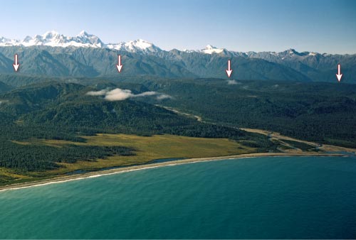
My first assignment sends me to west of Vancouver, Canada, to Explorer Ridge. This is a divergent boundary, and guess what? It’s underwater. So, that means I got to get all this swim gear on and go swimming with weird little fishies.

Explorer Ridge is the divergent tectonic plate boundary between the Explorer Plate and the Pacific Plate. It has a rift valley along the length of it, where the plates are moving apart. Magma rises to fill the gap, and cools to create new seafloor.

In the Southern Explorer Ridge there’s plenty of hydrothermal activity, too. Magic Mountain, a hydrothermal vent, formed sulfur deposits. All that sulfur must’ve affected the marine life there, because it was just swarming with strange little critters.

     The hydrothermal vents also create these types of sulfide “pillow lavas”:

This ridge is also seismically active: most activity recorded here was on the Explorer Transform Fault Zone.

I enjoyed seeing the rifts and the Ridge, looking at the result of a Divergent Plate Boundary, and seeing the rock formations formed from this result. On this trip, I got to dive and even go down in a small submarine!

Diagram of the depths of Explorer Ridge:

DETAILS DETAILS DETAILS:
If you want to know the minute details, Explorer Ridge is located off the coast of North America, off the west coast of Canada, from the latitude of 49 00°N – 50 20°N and a longitude of 130 00°W – 131 00°W.
If you ever want to get there, I suggest plugging in the location above, turning west off of Vancouver Island, and swimming to your destination.

-Carly